Showing posts with label walking. Show all posts

Thursday, 21 January 2016

Review of Fenix 3 Watch

I'd thought of buying an Apple Watch for some time before getting this instead. I work in an environment where getting your phone out to check emails, messages etc is frowned upon so this seemed a more discreet way of staying connected. I also like the idea of using a watch for basic navigation in the hills (see my previous post on my Casio).
But, although I am heavily committed to Apple, the watch didn't seem to be what I wanted. It doesn't have in-built gps, so you need to keep your phone with you at all times. It doesn't have its own app for fitness and tracking - you have to use third party apps like Strava, Runkeeper, Edmondo etc. And it isn't waterproof, so I'd worry about constantly checking it in a Highland downpour. The battery life is poor, compared to what I eventually bought. It does have a Viewranger app, but this wasn't enough to sway me.


A comparison of the screens of Fenix 3 and 2

So after a quick trial of the Fenix 2, which I sent back after a few days as the notifications drained the battery very quickly and the screen was nowhere near as good, I settled on the Fenix 3. I use it to record any walks, runs or bike rides I do. These are then automatically uploaded to Garmin's Connect website with routes, speed, ascent, pace amongst the information available. Routes can be exported from there, so I can import the routes into Viewranger and view them on a decent map.
The screen is excellent in sunlight, however bright. But from twilight onwards it's less easy to see. There is a backlight though, which can be configured to come on automatically.
I've yet to experiment with importing routes to the watch and then following them. There are simpler functions you can do directly from the watch, for example re-tracing your route, having directions to your starting point or any other point you record. I left a rucksack on a pathless slope to complete the summit and recorded its position as a waypoint.On my return I selected navigate to waypoint and the watch showed me the direction, distance and how long it would take to get there; all while continuing to record the whole route. It was very accurate.
Although the forums were, until the latest update, full of people complaining about gps inaccuracy I've yet to have a problem. Updates are frequent and continue to add functionality to the device: the most recent added new apps (activities you can record) such as indoor rowing, widgets (data screens you can access at any time), as well as automatic sleep tracking.
Notifications match those on your phone, so anything you have set up as a notification will appear on the watch screen. This is very useful as you can decide whether or not it's worth getting your phone out.
You can get further watch faces, apps, widgets and data screens from Garmin's Connect IQ store. I've tried a few watch faces out but none of them seem as good as the ones done by Garmin. I don't find any analogue watch face to be as good as the digital ones - why would you use a digital watch to copy, in rather a bad way, what analogue watches do?
I've worn this watch on every walk/run/bike ride/visit to the gym for the last 6 months and it looks as good as new. Battery life depends upon how many activities with GPS you record. I charge mine up every week, having used it for perhaps 5 or 6 hours of recording.
So far, I'm really pleased with the watch. There's still a lot I haven't tried out: following routes, pairing it to a heart rate monitor etc and the configurations of data screens within activities are endless and I haven't played with these much.
I'll finish with some pictures to give you a better idea of how apps, widgets and data screens look.


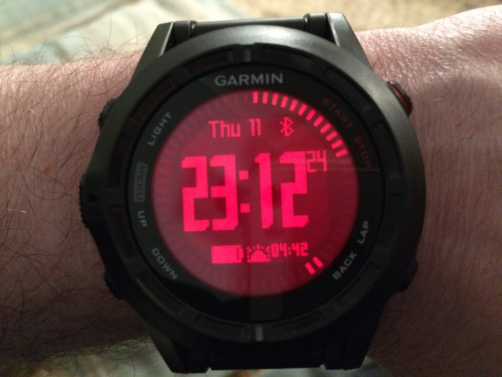
My current watch face
An email arriving


The activity widget, showing steps goal, total steps, distance, flights of stairs climbed and the red inactivity bar


That's an all-day event, I wasn't doing this in a staff meeting!


Walking app started, finding gps


Thursday, 11 October 2012

An Teallach retreat

We started visiting Scotland in 1986 - a week in Dunoon during Autumn, a week in Spring at Glenelg:
 the following Spring at Gairloch and then Summer 1987 in Ullapool:

 Each trip went further north, yet seemed to reveal endless landscapes northwards to be explored. I'll find some photos from those days and put them on here, with more details about those holidays, but for now, here's a quick description of our first attempt on a hill.

With the help of the wonderful Companion Guide to the West Highlands of Scotland, by WH Murray (still the only book you need for general exploration, and so beautifully written), we chose to try An Teallach from Dundonnell.


My dad in this photo is younger than I am now. I'm wearing Hawkins boots (wonderful, no longer in business), cheap gaiters from a shop in Keswick, corduroy trousers, cotton shirt (I'm not sure if I was just being stupid here or if there just weren't outdoor shops and magazines telling me about base layers), jumper knitted by my mum, Parks dept. issue jacket and a £1 hat. Spot the map case, later lost in the Fannichs - I was slowly getting better prepared and equipped. The walk up was straightforward until we hit mist and snow. Then we were in a different world - white everywhere, no visible path, just occasional rocks looming out of the snow. We continued as far as we dared, but visibility got so bad that we weren't sure we would find our way back if we went any further. So back we went.

We were disappointed at not reaching the top, so after a quick meal back at Gairloch we walked up up Glen Grudie, trying to reach Coire Mhic Fhearchair. This was a great walk but this time, darkness turned us back before we could reach our goal.

Little Loch Broom and Dundonnell behind us
 An Teallach from the Destitution Road

Sunday, 16 September 2012

Second Hill


I’d been to the Lake District before as part of a school trip. We’d climbed a few hills... but I couldn’t remember them, partly because of an outbreak of salmonella and partly because I was a teenager and not able to concentrate on anything other than girls, football and not getting hit. That disastrous trip to Snowdon had taught me something about being prepared. I now had a rucksack and, courtesy of Webberley’s of Hanley, appropriate maps and books on Lake District walks by Terry Marsh.
We decided on walk 4.4 – Red Pike, High Stile and High Crag from Buttermere. The car park was easy to find and so was the start of the walk, but somehow we managed to lose the path (years later I would laugh at an over-equipped walker on Coniston asking where the path was, when he was standing on it, yet there I was, having lost a 3 feet wide path). So we cut straight up the hillside and came across the path near to the tarn. I hadn’t learned how to pace myself – I kept charging off at full speed, getting out of breath and then having to stop. Meanwhile, children, pensioners, everyone else, overtook me. We eventually made it to the summit and took out our well-earned lunch. But I was wearing (and continued to do this for quite a few hills) a cotton shirt, soaked from my exertions and the wind on the ridge made me go cold very quickly. So we didn’t really stop until we were back at the car.
I’ve done this walk a couple of times since and thought: what was all the fuss about? Why did it feel like such a marathon? Wasn’t I young and fit? It was, nevertheless, a wonderful day, with great views and we were now addicted to hillwalking forever. There were lots of people around though – maybe Scotland would give us a greater sense of wilderness.

Saturday, 11 August 2012

Gear: walking on hedgehogs

I'm very fussy about footwear. For years I've done the hillwalking thing of always wearing boots. But wearing my normal boots makes my feet ache after about 8 miles. In my winter boots my feet start to scream after 4 miles. In these The North Face Hedgehogs I've covered much greater distances, including the 29 mile A'Mhaighdean one day epic.At the end of such walks my feet, instead of screaming "get these off, put something else on now", feel as if they could carry on walking forever. This is my 3rd pair, bought in a sale, they'll be locked away until my second pair wear out.
PROS

  • comfortable and very light, like wearing slippers
  • good grip
  • just enough support for you to feel what you're walking on, without it hurting
  • waterproof and breathable, I've never felt too cold or too hot
CONS

  • they're only shoes, so water can get in over the top - I always pack waterproof socks, just in case
  • they probably wear out quicker than boots, my first pair lasted 3 years - I never wear anything else on walks
I should say that my ankles are strong - I don't need boots to support my ankles - and I find the freedom of movement that using shoes gives me to be less wearing in general

Gear: Casio alt-6000


I bought this from Dixons, not long after they first came out, 1992 or so. It's been up every serious hill with me ever since. The altimeter is still very accurate, you just set it at the start of the walk. I set the altitude alarm for the summit on every walk and it always goes off at exactly the right time. Silly really, as you almost always know when you're at the top, but it amuses me. Everything works perfectly still. It's on its 4th battery (they last at least 5 years) and 2nd strap. You can't buy this model anymore obviously, but just in case you're wondering about reliability and longevity in Casio watches - you wouldn't believe how many other watches I've broken just working at school in the last 20 years, whereas this has been bashed about on the hills without any problem. I'm sure it will outlast me. I paid £85 for it in a sale, there's one on ebay at the min, current bid is £95. Not that I'm selling this!

Wednesday, 10 August 2011


On the way up to Gairich


The summit


Peaks of Knoydart and Kintail


Loch Quoich


All muscle
Both

Posted by Picasa

Scotland July 2011

A 3 day raid to try and nab our 100th Munro. We managed to leave home at 6am, stopped at Johnstonebridge and Spean Bridge for quick drinks, arriving at the start of the walk for Gairich at about 1.30.
We parked just before the dam at Loch Quoich. The path is easy to follow all the way up. Some scrambling near the top but nothing to worry about. Great views drawing you into Knoydart. The easiest place to eat on our way to Lochcarron seemed to be the Cluanie Inn - good food, friendly service and we've never been turned away, whatever time we appeared. It didn't disappoint but the midges on the car park were ferocious. On to the Lochcarron Hotel - £40 a night B and B. Good bar, good breakfast, rooms a little past their best with quite a bit of hair in the bath! The next day we tried Maol Chinn-dearg, as it was the only hill out of the clouds. A great path starts from Coulags, crosses the river, passes a great bothy. After this and the legendary finger-shape rock we forked left and then right at the top of the col. Easy up to this point, from then on there was a bit of wading through a boulder field, nothing too bad though. Should have been a great view but we couldn't see much!
Quite a bit of rain on the way back, plenty of midges by the car park too. We drove over the Bealach Na Ba for tea - the best fish and chips in the world at the glorious Applecross Inn. Those two hills were our 99th and 100th Munros. On the way back home we stopped at Perth - a quick walk up Kinnouill Hill before eating where Cafe Roma once was - new owners just as friendly but the food isn't as good. Need to find a new place to eat in Perth soon!